


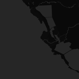

Real-time Australian emergency incident data, for the platforms that depend on it.
Structured emergency data for utilities, insurers, government, and media. 28 emergency data feeds across all 8 states, unified into one integration.
The problem with Australian emergency data
Australian emergency services publish incident data across dozens of separate feeds in different formats. Integrating them yourself means maintaining connections to each one, handling format differences, and dealing with upstream changes.
- Poll 30+ feeds yourself
- Parse 8 different data formats
- Handle upstream changes and outages
- Build your own geocoding pipeline
- No historical archive
- One API call
- Unified GeoJSON schema
- We handle upstream changes
- Coordinates on every incident
- 4.8M+ archived incidents
Built for
Built for enterprise integration
Full compliance details at /compliance.
Designed to supplement, not replace
Your organisation already has primary emergency alert channels. EmergencyAPI provides the structured data layer alongside them. Searchable, filterable, historical. Built for integration into your existing systems, not to compete with official warning channels.
Live Feed Status
| State | Agency | Status | Incidents | Last Polled |
|---|---|---|---|---|
| ACT | ESA-ALL | healthy | 5 | < 1 min |
| ACT | ESA-FDR | healthy | 0 | < 1 hr |
| ACT | ESA-CURRENT | healthy | 5 | < 1 min |
| NATIONAL | GA | healthy | 3 | < 1 hr |
| NATIONAL | GA-HOTSPOTS | healthy | 72 | < 15 min |
| NSW | RFS | healthy | 19 | < 1 min |
| NSW | SES | healthy | 0 | < 5 min |
| NSW | RFS-WARN | healthy | 0 | < 5 min |
| NT | PFES | healthy | 47 | < 15 min |
| QLD | QFD-WARN | healthy | 23 | < 1 min |
| QLD | QFD | healthy | 30 | < 5 min |
| SA | MFS | healthy | 2 | < 5 min |
| SA | CFS | healthy | 5 | < 5 min |
| SA | SAAS-PAGER | healthy | 342 | < 5 min |
| SA | CFS-PAGER | healthy | 7 | < 1 min |
| SA | BOMBER-PAGER | healthy | 0 | < 5 min |
| SA | SES | healthy | 0 | < 5 min |
| SA | SES-PAGER | healthy | 37 | < 1 min |
| TAS | TFS | healthy | 0 | < 15 min |
| TAS | TASALERT | healthy | 0 | < 5 min |
| TAS | TASALERT-RSS | healthy | 0 | < 5 min |
| VIC | EMV-FIRE | healthy | 44 | < 1 hr |
| VIC | SES | healthy | 13 | < 5 min |
| VIC | EMV-FLOOD | healthy | 4 | < 1 hr |
| VIC | CFA-FDR | healthy | 5 | < 15 min |
| VIC | EMV | healthy | 88 | < 1 min |
| WA | DFES | healthy | 35 | < 1 min |
| WA | DFES-WARN | healthy | 2 | < 15 min |
Quick start, sample response, API endpoints, and features.
Guides and Tutorials
Data Sources
Sourced from official Australian government and national data feeds:
QLD QFD · NSW RFS · VIC EMV · SA CFS/MFS/SES · WA DFES · ACT ESA · TAS TFS · NT PFES · GA Earthquakes · DEA Hotspots
See /v1/attribution for full licence details.
Get started
500 requests per day on the free tier. No credit card. No approval process.